

And Why Is Jerusalem Located There?
Original Jerusalem was a narrow ridge outside today’s Old City walls, smaller than many shopping centers. Everything about the city’s history follows from one spring at the bottom of it.
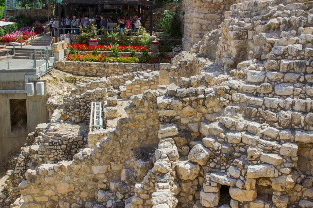
Visitors are regularly surprised by two things about the City of David. It sits outside the walls of the Old City, downhill and to the south, so you leave the famous walls to reach the oldest part of the town. And it is small. The original city covered roughly eleven or twelve acres, a narrow ridge you can walk end to end in fifteen minutes.
Both surprises have the same explanation, and it is sitting at the bottom of the eastern slope.
The spring decides everything
The Gihon Spring is the only reliable year-round water source in the area. In a landscape where the rain falls in a few winter months and the summers are long and dry, a permanent spring determines where people can live. The city is on that ridge because the spring is at the foot of it.
That single fact explains the shape of ancient Jerusalem. The ridge is narrow, steep on two sides, and defensible. It is also cramped, which is why the city stayed small for centuries and why it eventually spread onto the western hill as the population grew. And it explains why the Old City walls you photograph today, built by the Ottomans in the 1500s, leave the original city outside: by then the center of town had moved north and west, and the founding ridge had become hinterland.
What David captured
Before David, the ridge held a fortified Jebusite town. The account of its capture contains one of the most argued-over verses in the Old Testament: “And David said on that day, Whosoever getteth up to the gutter, and smiteth the Jebusites… he shall be chief and captain” (2 Samuel 5:8).
The word rendered gutter is rare and its meaning uncertain. A popular reading takes it as a water shaft, and connects it to a vertical shaft discovered by a British engineer in 1867 that runs down toward the spring. The image of Joab climbing that shaft in the dark has appeared in countless retellings.
Excavation has complicated the story. Study of the spring area has revealed enormous fortification towers around the water source, built long before David, and has raised real questions about whether the shaft was in use, or even open, in his time. Some scholars now read the word as a pipe, a hook, or a part of the fortifications rather than a shaft. The capture happened. How it happened is less settled than the retellings suggest.
Is the Large Stone Structure David’s palace?
Near the top of the ridge, excavation has uncovered massive walls of a large public building, along with a great stepped stone support structure holding up the slope below it. The archaeologist who directed that work identified the building as David’s palace, connecting it with the account of a house built for the king.
The identification is disputed. Other archaeologists date the walls later, or read them as separate structures from different periods rather than one building, or accept the size while declining the name. This debate sits inside a larger and often heated argument about how large and organized Jerusalem was in the tenth century BC.
What can be said plainly is that a very substantial public structure stood at the summit of the ridge, and that the argument concerns its date and its owner rather than its existence.
The tunnel and the pool
The most impressive thing on the ridge is a water project. Around 701 BC, with an Assyrian army approaching, Hezekiah cut a tunnel more than a quarter mile through solid rock to bring the spring water inside the city walls and hide the source from the besiegers. Two crews worked from opposite ends and met in the middle. An inscription cut into the tunnel wall describes the moment they broke through and heard each other’s voices. That inscription was found in 1880 and now sits in a museum in Istanbul.
You can walk the tunnel today, in the water, end to end. It remains the single best experience on the ridge and one of the few places anywhere that you can move through an engineering project described in scripture while it is still doing its job.
The water eventually reaches the Pool of Siloam, where the man born blind was sent to wash (John 9:7). A monumental stepped pool of the correct period was uncovered here in 2004 during unrelated construction work, and excavation of it, along with the stepped street that ran from the pool up toward the temple, has continued since.
Why the City of David comes first on an itinerary
Visiting this site is a revelation. Standing here reorganizes the whole city.
From the summit you can see how the pieces fit: the spring below, the narrow ridge running north toward the temple platform, the Kidron valley on the east with the Mount of Olives rising beyond it, and the western hill across the way that later generations would mistakenly name Mount Zion. Every location in the Gospels sits within that frame, and most of them within a mile.
People arrive imagining Jerusalem as a vast ancient capital. It began as a village on a ridge beside a spring, and the story that came out of it reached everywhere. And now the past is physically accessible in the present.
Come and See
Why did David choose this narrow ridge for his capital?
Walk the oldest Jerusalem with us.
| Explore Upcoming Departures | Prepare To Be A Pilgrim |
 |

Sources and Further Reading
- Amihai Mazar, Archaeology of the Land of the Bible: 10,000–586 B.C.E. (Doubleday, 1990).
- Eilat Mazar, The Palace of King David: Excavations at the Summit of the City of David — Preliminary Report of Seasons 2005–2007 (Shoham Academic Research and Publication, 2009).
- Ronny Reich, Excavating the City of David: Where Jerusalem’s History Began (Israel Exploration Society, 2011).
