

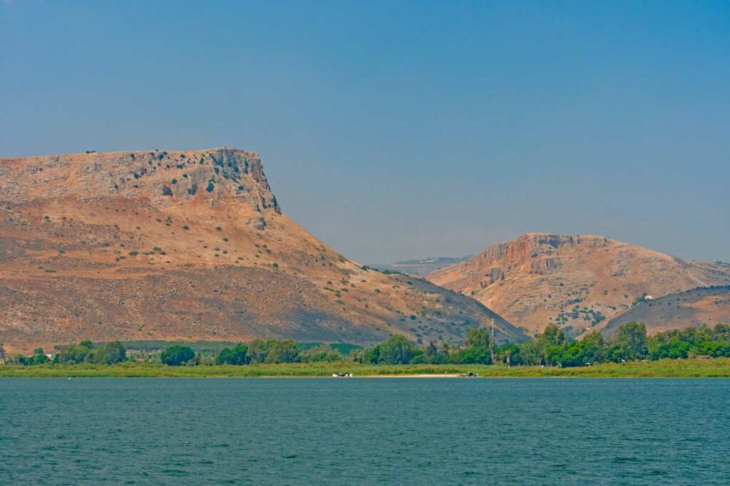
The Overlook Above the Sea of Galilee
A cliff nine hundred feet above the lake, a pass that carried the main road, and caves where a Roman-backed king lowered soldiers on ropes to root out rebels.
If a group has time for only one overlook in Galilee, this is the one. From the top of Arbel the entire lake lies below you, ringed by the Golan and closed at the north end by Mount Hermon. Nearly every place in the Galilean ministry is inside that single view. And the international highway runs at its base, connecting to Capernaum and then beyond, eastward toward the Silk Road and westward to the Mediterranean.
The Arbel pass and the road to Capernaum
Arbel matters for a reason beyond the view, and it is the reason to stop here rather than at any other height.
The cliffs stand on the north side of a valley that cuts down from the hills of Lower Galilee to the lakeshore. That valley carried the main road. Traffic moving between the coastal plain and Damascus, and traffic coming down from Nazareth toward the lake, funneled through this pass and came out at the shore near Magdala.
Which means that when Jesus left Nazareth and went to dwell in Capernaum (Matthew 4:13), the natural route ran through the gap below this cliff. Standing at the top, you are looking down at the road He took to begin His ministry. You are also seeing a major chunk of the territory where He conducted that ministry.
The caves and what actually happened there
Look at the cliff face and you can pick out openings, some with stonework built across them. These are fortified caves, occupied and reinforced over many centuries.
They have a grim moment in the historical record. In the years before he consolidated power, Herod campaigned against rebels who had taken refuge in these caves, and Josephus describes soldiers being lowered down the cliff face from above in baskets to reach the openings where the rebels were hiding. It was brutal, and it worked.
One correction is worth making here, because it circulates widely on itineraries and in tour notes. Herod was not crowned king at Arbel. He was declared king of Judea by the Roman Senate, in Rome, and then had to come back and take the territory by force. Concluding the fight at Mount Arbel was one of the campaigns by which he made that title real.
Later the site held a Jewish village. The remains of its synagogue, built in the centuries after the New Testament, can still be seen near the base of the mountain.
The mountain of the Great Commission
Matthew ends his Gospel on a mountain: the eleven went into Galilee, “into a mountain where Jesus had appointed them” (Matthew 28:16), and there received the commission to teach all nations.
Matthew does not name the mountain. Arbel is one proposal, and a reasonable one: it is the dominant height in the region, it is close to Capernaum, and a group would have no trouble finding it. Mount Tabor carries an older tradition. Others read Matthew’s mountain as a theological setting rather than a specific peak, echoing the mountain of the Sermon and Sinai before it.
Take it as a strong candidate rather than a settled identification. And then consider what standing here does to the commission itself. You can see the whole of the Galilean ministry from this cliff, every town, the lake, the roads. And the instruction given on a mountain in Galilee was to go to all nations, spoken within sight of the highway that stretched east and west toward them.
How to reach the summit of Mount Arbel
Typically we drive to the top of the national park and walk a short, relatively easy path to the overlook. That is what most pilgrims do and it delivers the entire view.
Or you can take the cliff trail, which descends the rock face using cut footholds and iron handholds. It is a genuine scramble, exposed in places, and it should be attempted only by people who are sure-footed and comfortable with heights.
Go in the morning if you can, when the light is behind you and the lake is clear. Afternoon haze often softens the far shore.
Come and See
How might one view of the whole Galilee basin open up new understanding of the Gospels?
Stand at the cliff edge with us.
| Explore Upcoming Departures | Prepare To Be A Pilgrim |
 |

Sources and Further Reading
- Josephus, The Jewish War, book 1, on Herod’s campaign against the cave strongholds.
- Jodi Magness, The Archaeology of the Holy Land: From the Destruction of Solomon’s Temple to the Muslim Conquest (Cambridge University Press, 2012).
- Jerome Murphy-O’Connor, The Holy Land: An Oxford Archaeological Guide from Earliest Times to 1700, 5th ed. (Oxford University Press, 2008).
